Description
Western Arthur 1:50,000 Topographic Map
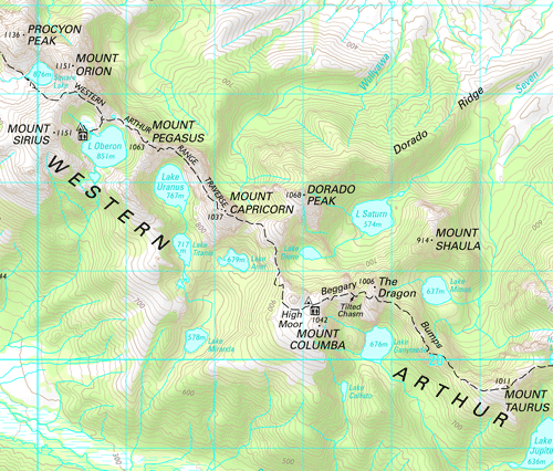
The Western Arthur 1:50,000 Topographic Map covers the entire Western Arthur Range in the wilderness areas south of Lake Pedder.
This map contains the entire Western Arthur Range, and several important tracks that give access to the Eastern Arthur Range, Port Davey and the Huon feature on the map.
See our Print on Demand Western Arthurs 1:25,000 map
Features on this map include the start of the Mount Anne Track, and Lake Oberon, Scotts Peak Dam, Mount Hayes (1119m), Procyon Peak (1136m), Mount Orion (1151m), Mount Scorpio (1106m), Mount Aldebaran (1107m) and West Portal (1181m).


