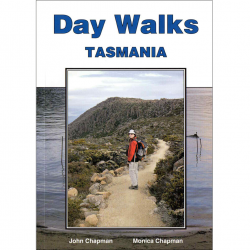
Description
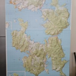
Tasman Peninsula Walks Map
With a unique new format, the Tasman Peninsula Walks map provides multiple map windows to provide maximum coverage of the Tasman Peninsula while still folding to fit into your shirt pocket. The new map will be an essential reference, whether you are going for a leisurely day walk or for a week-long adventure. The new A3 format map covers all Three Capes Tracks; Cape Pillar, Hauy and Raoul, as well as the Lime Bay State Reserve and other popular peninsula walks; including the Tasman Coastal Trail, Waterfall Bay, Tunnel Bay and Mount Brown.
Whilst this map is up to date, it’s ‘inset’ format doesn’t make it the best map for the Tasman Peninsula. The 1:50,000 Tasman Peninsula Map remains the best topographical map for the area.
This map highlights walk times, difficulty levels, public camping and facilities and features tourist information along with general topographic detail.